
Page 266 - Special Topic Session (STS) - Volume 4
P. 266
STS583 Yakob M. S.
to 50–100 holdings, such that one enumerator can collect the data relating to
a subset of EAs during the census period (Geospace, 2007). Based on projects
carried out in Lesotho, Namibia, the Seychelles and the United Republic of
Tanzania (Loots, 2015), the significant savings that may be achieved in terms
of time and fieldwork, largely repay the costs of adopting the required
technology (i.e. imagery, GIS, expert consultancies and training). The general
quality of undertaking the census also improves, due to better planning,
transparency and traceability of the work. In addition, all of the infrastructure
created can easily be reused in subsequent efforts, which is of particular
interest and benefit if a Master Sampling Frame (MSF) approach is adopted
(Global Strategy, 2015b).
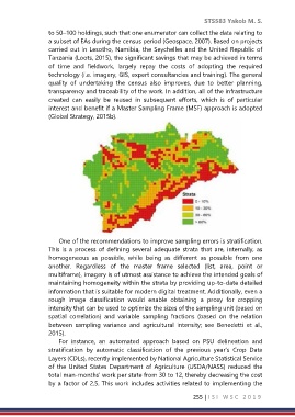
One of the recommendations to improve sampling errors is stratification.
This is a process of defining several adequate strata that are, internally, as
homogeneous as possible, while being as different as possible from one
another. Regardless of the master frame selected (list, area, point or
multiframe), imagery is of utmost assistance to achieve the intended goals of
maintaining homogeneity within the strata by providing up-to-date detailed
information that is suitable for modern digital treatment. Additionally, even a
rough image classification would enable obtaining a proxy for cropping
intensity that can be used to optimize the sizes of the sampling unit (based on
spatial correlation) and variable sampling fractions (based on the relation
between sampling variance and agricultural intensity; see Benedetti et al.,
2015).
For instance, an automated approach based on PSU delineation and
stratification by automatic classification of the previous year’s Crop Data
Layers (CDLs), recently implemented by National Agriculture Statistical Service
of the United States Department of Agriculture (USDA/NASS) reduced the
total man-months’ work per state from 30 to 12, thereby decreasing the cost
by a factor of 2.5. This work includes activities related to implementing the
255 | I S I W S C 2 0 1 9