
Page 94 - Contributed Paper Session (CPS) - Volume 7
P. 94
CPS2036 Mahdir B. et al.
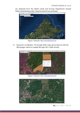
are obtained from the Sabah Lands and Surveys Department website
(http://www.jtuwma.net/) using the search box provided.
Figure 3: Website http://www.jtuwma.net/
iii. Using the coordinates, The Google Earth map can be layered with the
EBs polygon which is created through GIS in KML format.
Figure 4: Website http://www.jtuwma.net/
81 | I S I W S C 2 0 1 9