
Page 106 - Contributed Paper Session (CPS) - Volume 7
P. 106
CPS2042 Anna Christine D. et al.
1
Democratic Republic (Lao PDR), Thailand, and Viet Nam —and compares
them to estimates obtained from existing administrative data sources. The
pilot provinces were stratified into rice growing areas using satellite data and
GIS methods and within each stratum, square meshes were randomly selected
to identify plots eligible for crop cutting. Crop cutting was then implemented
in randomly selected subplots to obtain unbiased rice yield estimates. This
allowed for the calculation of both direct and indirect estimates of total paddy
rice area.
2. Data Description and Methodology
An area frame was used for this study and constructed based on the
expected likelihood of finding paddy rice area in each grid square mesh. Two
sources of rice maps were utilized to implement the stratification process: (i)
rice extent maps using 2015 MODIS data produced by the International Rice
Research Institute (IRRI) and (ii) land use maps from 2009 produced by the
2
European Space Agency (ESA) under its GLOBCOVER initiative. These two
3
sources allow for identification of land most recently used for growing rice
alongside providing information on those areas which are repeatedly used for
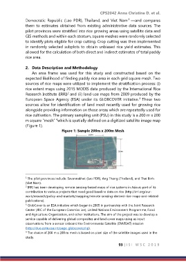
rice cultivation. The primary sampling unit (PSU) in this study is a 200 m x 200
4
m square “mesh” which is spatially defined on a digitized satellite image map
(Figure 1).
Figure 1: Sample 200m x 200m Mesh
1 The pilot provinces include: Savannakhet (Lao PDR), Ang Thong (Thailand), and Thai Binh
(Viet Nam).
2 IRRI has been developing remote sensing-based maps of rice systems in Asia as part of its
contribution to various projects that need good baseline data on rice (http://irri.org/our-
work/research/policy-and-markets/mapping/remote-sensing-derived-rice-maps-and-related-
publications).
3 GlobCover is an ESA initiative which began in 2005 in partnership with the Joint Research
Center (JRC of the European Commiss ion), United Nations Environment Programme, Food
and Agriculture Organization, and other institutions. The aim of the project was to develop a
service capable of delivering global composites and land cover maps using as input
observations from a sensor onboard the Environmental Satellite (ENVISAT) mission
(http://due.esrin.esa.int/page_globcover.php).
4 The choice of 200 m x 200 m mesh is based on pixel size of the satellite images used in the
study.
93 | I S I W S C 2 0 1 9